




RismadarVoice Reporters
September 19, 2026
The devastating floods that struck Nepal and neighbouring Tibet in August have intensified concerns over weaknesses in early-warning systems across the Himalayas, as scientists warn that climate-driven changes are making mountain disasters increasingly difficult to predict.
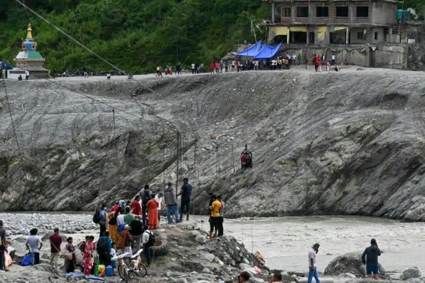
The August 26 disaster began when a huge mass of ice and rock broke loose in the mountains above Nepal’s Rasuwa district, sending water, mud and debris through valleys towards the Nepal-China border.
By mid-September, more than 1,400 people had reportedly died while at least 6,000 remained missing across affected areas of Nepal and Tibet. Twelve hydropower plants were also destroyed, alongside roads, bridges, homes and other infrastructure.
Scientists say the disaster demonstrated the danger posed by cascading mountain hazards, where one event can rapidly trigger several others.
An ice or rock avalanche, for example, can temporarily block a river and create a lake. If the obstruction subsequently collapses, the accumulated water and debris can surge downstream, damaging infrastructure and potentially triggering further flooding.

WARNING SYSTEMS FACE NEW CHALLENGE
Experts say many existing early-warning systems are designed to monitor specific hazards such as rainfall, rising river levels or glacial lake outburst floods.
The Nepal disaster exposed the limitations of that approach because the initial trigger occurred high in the mountains rather than beginning simply with heavy rainfall or a steadily rising river.
Scientists examining the event have focused on an ice-rock avalanche and other high-altitude processes that may have disrupted the river system before the destructive surge developed.
That means communities downstream could have only a short period to respond if monitoring systems detect danger only after water levels begin rising.
Climate change is adding to the challenge by altering glaciers, snow cover, permafrost and high-altitude lakes across the Himalayan region.
At the same time, settlements, roads, tourism facilities and hydropower projects are expanding deeper into mountain valleys, increasing the number of people and infrastructure potentially exposed to disasters.
RISKS EXTEND ACROSS HIMALAYAS
Concerns are not limited to Nepal.
Research in Indian-administered Kashmir identified 155 glacial lakes above 2,500 metres, with the area occupied by lakes directly connected to glaciers increasing by about 26 per cent between 1992 and 2024.
Five were classified as highly susceptible to glacial lake outburst floods, with researchers warning that a major event could threaten buildings, bridges, roads and hydropower infrastructure.
Pakistan has also been expanding early-warning systems in vulnerable valleys, particularly around Gilgit-Baltistan, where hundreds of glaciers and glacial lakes exist alongside settlements and infrastructure.
Scientists, however, caution that monitoring technology alone is insufficient. Warnings must reach threatened communities quickly, residents must understand what they mean, and safe evacuation arrangements must already be available.
CROSS-BORDER COOPERATION
Another major concern is that Himalayan hazards frequently cross international boundaries.
The mountain system stretches across several countries, while major rivers originating there flow through multiple jurisdictions. A dangerous event beginning in one country can therefore threaten communities downstream in another.

Experts are calling for stronger cross-border sharing of satellite observations, river measurements, glacier monitoring and other hazard information.
The August disaster damaged the Gyirong crossing on the Nepal-China border, highlighting how quickly a high-altitude event can affect international transport and trade infrastructure.
Scientists say the challenge is becoming increasingly urgent as historical flood records become less reliable for predicting future risks in a rapidly changing climate.
The Himalayas, sometimes described as the “Third Pole” because of their enormous concentration of snow and ice outside the Arctic and Antarctic, supply water to major Asian river systems supporting hundreds of millions of people.
Experts say future disaster preparedness will therefore increasingly depend on monitoring multiple hazards simultaneously, improving early-warning networks and ensuring critical information can move rapidly across borders before disasters reach communities downstream.