




RismadarVoice Reporters, August 29, 2026
Nepalese authorities are monitoring two lakes located upstream of a flood-hit area near the Nepal-Tibet border, warning that the risk of further flooding will remain until the water bodies are fully drained.
An official with Nepal’s Disaster Management Authority said one of the two lakes began overflowing on Friday, prompting continued monitoring of conditions in the region where hundreds of people were killed following a glacier collapse.

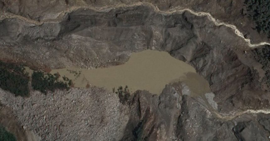
Satellite images showed the lakes near the area where the glacier collapse sent rocks, ice, mud and debris into river systems on Wednesday, creating powerful flood waves that destroyed houses, bridges and other infrastructure.
Aerial footage captured by a Chinese rescue team showed the formation of one of the lakes, with large volumes of brown water accumulating in a basin. New satellite images later indicated that water from the lake had started draining.
However, another lake located further upstream appeared to be increasing in size, with no visible outlet detected, raising concerns that water pressure could continue building.
Nepalese authorities said they are using satellite imagery to monitor the situation but noted that access to updated images remains limited.
The government is also planning to install cameras and sensors downstream, including near the border town of Timure, while assessing the possibility of deploying monitoring equipment by helicopter.

The glacier-related disaster has caused widespread destruction in the mountainous region, with rescue teams continuing efforts to assess damage and locate missing people.
Authorities said flood risks would continue until the affected lakes have completely drained and conditions in the area become stable.